If you are planning a trip to Kashmir, offline maps can save you from a lot of unnecessary stress. Mobile data may work well in Srinagar and along some tourist routes, but it can become patchy in mountain stretches, near high-altitude passes, and in smaller villages. This guide will help you plan navigation for Kashmir confidently, so you can focus on the views, not the signal bars.
Why offline navigation matters in Kashmir
Kashmir is one of those destinations where the road itself is part of the experience. You may be driving from Srinagar to Gulmarg, heading into Pahalgam, crossing the Sonamarg corridor, or continuing towards Doodhpathri and Yusmarg. Along these routes, network coverage can drop suddenly, especially in forested patches, remote valleys, and after you leave town limits.
That matters because Kashmir travel often involves flexible plans. A road closure, a weather delay, a local taxi detour, or a change in sightseeing order can happen quickly. Offline maps let you check routes, estimate drive times, and find your next stop even when your phone shows no signal. For most travellers, this is less about convenience and more about avoiding confusion on unfamiliar roads.
What offline maps can and cannot do
Offline maps are excellent for route finding, identifying towns, and keeping track of your location. They are useful when you want to navigate between Srinagar, Gulmarg, Pahalgam, Sonamarg, Anantnag, Kupwara, or remote picnic spots without depending fully on mobile data.
But offline maps are not a replacement for local judgement. In Kashmir, road conditions can change because of snowfall, landslides, fog, army movement restrictions, or temporary route diversions. A map app may show a road as open even when locals know it is temporarily risky or closed. Use offline maps as a guide, then cross-check with your driver, hotel staff, or local operators before committing to long drives.
Best offline map apps for Kashmir travellers
Most travellers will do well with one primary app and one backup app. Before you leave your hotel in Srinagar, download the maps for the regions you plan to visit. Do this on Wi-Fi, not while waiting in a taxi or at the airport.
| App | Why it helps in Kashmir | Best use case |
|---|---|---|
| Google Maps | Easy to use, good for saved places and route previews | Most first-time travellers |
| Maps.me | Works well offline and is handy for basic navigation | Travel in areas with weak data |
| Organic Maps | Lightweight, privacy-friendly, reliable offline base maps | Backup navigation on the go |
| Waze | Useful where live traffic data is available | Limited use in mountain areas, better in cities |
For Kashmir, Google Maps is usually the easiest starting point because you can save places like your houseboat in Dal Lake, your hotel in Srinagar, or a parking point near a sightseeing area. Maps.me and Organic Maps are excellent backups if you want a pure offline option. If you are travelling by hired cab, your driver may still rely more on local knowledge than app directions, which is common in Kashmir.
How to set up offline maps before your trip
Set your maps up before you reach Kashmir or during a strong Wi-Fi session in Srinagar. A rushed download at a café or petrol station is often the moment something goes wrong, so do it early.
- Download the Kashmir region map in your chosen app.
- Save key places: your hotel, Srinagar airport, Dal Lake, Shankaracharya Temple, Mughal Road entry points if relevant, and any day-trip destinations.
- Rename saved spots clearly, such as “Hotel Srinagar,” “Pahalgam stay,” or “Gulmarg taxi stand.”
- Test the app by switching on airplane mode and checking whether the map still opens.
- Keep your phone location services on, as GPS can work even without mobile data.
If your trip includes multiple bases, download each area separately. For example, a Srinagar-Gulmarg-Pahalgam itinerary needs at least three practical map zones. If you are continuing to Sonamarg or planning a longer drive toward Kupwara or Bandipora, add those areas too. A little preparation can save you from repeatedly loading maps in weak-signal zones.
Where connectivity is usually weak in Kashmir
Connectivity in Kashmir is uneven, and that is normal. In Srinagar city, internet and GPS assistance are generally easier to use, though even there the signal can fluctuate. Once you move into the hills, your experience may change quickly.
Areas where you should not depend fully on live data
Expect patchy connectivity on stretches from Srinagar to Gulmarg, especially as you move into higher terrain. The road to Pahalgam is generally manageable, but phone signal can still become inconsistent once you leave the main town areas. Sonamarg and routes beyond it can also be uneven, particularly in weather-sensitive months. In remote meadows, forest roads, and high passes, offline maps are far more dependable than a live connection.
If your itinerary includes winter travel, plan for even more interruptions. Snowfall can affect both the road network and data availability, and you may not want to be searching for an app while standing in cold weather with limited battery life. In those conditions, downloading routes in advance is not optional; it is essential.
Smart navigation habits for Kashmir roads
Offline maps work best when you use them with practical road sense. Kashmir roads are scenic, but they can also be narrow, winding, and affected by weather. A map app may show the shortest route, but that is not always the easiest or safest route for the day.
Use the map, then ask locally
Before a long drive, ask your driver, hotel manager, or local cab operator about road conditions. A 60-90 minute drive can easily stretch longer if there is traffic near tourist choke points, road work, or a weather-related slowdown. Local advice matters more than app estimates in the mountains.
Keep screenshots of important details
Take screenshots of your hotel booking, the cab number, and a few key directions. If you are travelling with family, this is especially helpful when one phone battery dies or someone’s device loses signal. It also helps in crowded places like Srinagar market areas, where you may need a quick reference point.
Download routes, not just places
Many travellers save only the destination pin. In Kashmir, it is better to download the full route in advance for your day trips. That way, if the network drops, you still have turn-by-turn context, nearby landmarks, and a sense of how far you are from the next junction.
Phone battery, power banks and practical backup planning
Offline maps are only useful if your phone stays charged. Long sightseeing days in Kashmir often mean extended time in a cab, several photo stops, colder temperatures, and limited charging options. Cold weather drains batteries faster, especially in places like Gulmarg or during early morning departures.
Carry a reliable power bank, ideally one with enough capacity to recharge your phone at least once or twice. Keep a charging cable in your day bag, not buried in luggage. If you are using your phone for photography, map navigation, messaging and payments, battery management becomes part of the travel plan. A 10,000 mAh power bank is usually enough for a day trip, while more active users may prefer a 20,000 mAh unit.
You should also tell at least one travel companion where you are going each day. If you are travelling solo, share your route with your hotel or family before leaving. Offline maps help you move confidently, but basic trip-sharing is still a sensible habit.
Cash, taxis and last-mile navigation in Kashmir
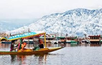
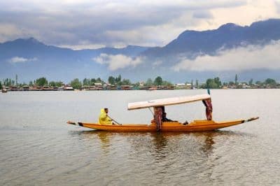
Navigation in Kashmir is not only about roads. It is also about reaching the correct pickup point, finding the right cab stand, and understanding local movement around attractions. In Srinagar, for example, you may need to coordinate with shikara operators, hotel boats, or local taxis rather than relying on app-based ride services. In hill towns, parking may be some distance from the main attraction, so your map should help you handle the final walk too.
Carry some cash for local transport, parking fees, or small service charges. While digital payments have become common in many places, network issues can still interrupt transactions. For taxi budgets, expect approximate day-ride rates to vary widely by season and route, with local sightseeing cabs often quoted as package-based fares rather than metered rides. Always confirm the price before departure, as seasonal demand in Kashmir can push prices higher.
Sample travel plan and navigation checklist
If you are doing a short Kashmir trip, a simple navigation setup is enough. For example, a 4-5 day itinerary with Srinagar, Gulmarg and Pahalgam usually needs one main offline map app, one backup app, and a list of saved places. That covers most common movement without overcomplicating your phone.
- Download Kashmir maps on Wi-Fi before travel
- Save hotel, airport, taxi stand and sightseeing points
- Keep a power bank ready every morning
- Ask locals about road conditions before long drives
- Do not rely only on live traffic updates
- Carry cash for small expenses and local transport
If your plan includes offbeat locations, you may also want to save nearby towns and service points. Even if the exact road name is not familiar, the next larger town can act as your navigation anchor. This is especially useful when you are on the move between villages, gardens and forested stretches where signboards may be limited.
Frequently Asked Questions
Do offline maps work without internet in Kashmir?
Yes, once you download the map area, you can use it without mobile data. Your phone’s GPS can still show your location even if the signal is weak. However, real-time traffic and road closure updates will not always be available offline, so use local advice too.
Which map app is best for Kashmir?
Google Maps is usually the easiest for most travellers because it is familiar and simple to save places on. Maps.me and Organic Maps are good backups if you want stronger offline support. It is smart to keep two apps ready in case one behaves poorly in low-signal areas.
Should I rely on Google Maps for mountain routes in Kashmir?
You can use it for general navigation, but do not treat it as the final authority in the mountains. Road conditions can change quickly because of weather, construction or local restrictions. Always check with your driver or hotel before a long trip, especially in winter.
Will I get network coverage in Srinagar and tourist areas?
Coverage is generally better in Srinagar than in remote hill stretches, but it still may vary by area and provider. Tourist towns often have usable signal, while forest roads and higher elevations can be patchy. If your trip depends on connectivity, prepare for interruptions.
How much should I budget for local transport in Kashmir?
Costs vary by season, distance and vehicle type, so there is no fixed rate that works all year. For sightseeing cabs, drivers often quote package fares, while shorter local rides may be priced differently. Ask for an indicative fare before starting the trip and confirm it at the time of booking.
What should I do if my map stops working on the road?
First, switch to your offline app or offline-downloaded area. If that still does not help, stop safely and ask a local shopkeeper, driver or hotel contact for directions. In Kashmir, local guidance is often faster and more reliable than trying to troubleshoot your phone while moving.
Offline maps make Kashmir far easier to enjoy, especially when you are moving between valleys, hill towns and scenic detours. If you prepare your apps, charge your phone, and stay flexible with road conditions, you will travel more smoothly and with far less worry.
If you found this guide useful, share the post with fellow travellers planning a Kashmir trip.
Planning a Kashmir trip?
Tell us your dates and who is travelling. Up to three local travel companies send you their itinerary and price.
Get free quotesDisclaimer: The information in this blog is for general information only. We try to keep it accurate and up to date, but TravelSetu accepts no liability for errors or omissions. If you believe any part of it infringes your rights, please write to info@travelsetu.com.