Seven Sisters River Port History
If you are planning a trip to the Seven Sisters and want more than scenic viewpoints and tea gardens, this article will give you a deeper layer of context: how the region’s rivers shaped trade, settlements, politics, and everyday life. By the end, you will understand why the old river ports of Assam and the wider Northeast are more than transport stops; they are the starting points of much of the region’s history.
The Seven Sisters have always been tied to water. Long before modern highways and airports, the Brahmaputra, Barak, and their tributaries carried people, rice, salt, timber, tea, cloth, and ideas across the Northeast and into Bengal and beyond. If you are curious about heritage travel, riverfront walks, and the stories behind old ports, this guide will help you see the region in a very different way.
Why rivers mattered so much in the Seven Sisters
In the Seven Sisters, geography is not just background; it is destiny. Mountain ranges, thick forests, floodplains, and long river corridors made roads difficult for centuries. Rivers became the easiest natural highways, especially in Assam, where the Brahmaputra and Barak systems connected market towns, royal capitals, tea estates, and riverine villages.
That is why so many settlements grew near ghats, ferries, and river docks. A town with access to the river could collect taxes, move goods, host traders, and support a larger population. In practical terms, river access meant survival during some seasons and prosperity in others. Even today, many people in Assam still rely on ferries and country boats for daily movement, especially in areas where bridges are few or distances are long.
The Brahmaputra: the great trading corridor of Assam
The Brahmaputra is the most important river in the Seven Sisters when it comes to port history. It runs through Assam as a wide, powerful artery that has long connected eastern Assam to central Assam and to river routes leading westward. During colonial times, steamers and cargo boats used the river heavily, especially as tea production expanded in Upper Assam.
Old river ports and landing points developed along this route because the river made heavy cargo movement cheaper than overland travel. Tea from Jorhat, Dibrugarh, and nearby districts could be moved to larger loading points, while timber, coal, and agricultural products travelled in the opposite direction. The river was also crucial for military and administrative control, which is why the British invested in steamer services and port facilities.
Guwahati as a river gateway
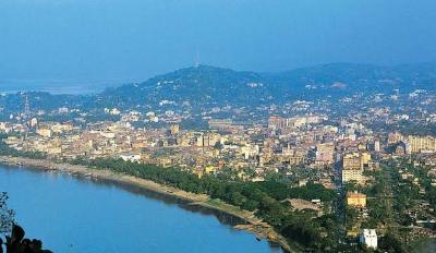
Guwahati is not just the biggest city in Assam; historically, it has also been one of the region’s most important river gateways. The ghats near the Brahmaputra have long served ferries, passenger boats, and cargo movement. Today, the riverfront still reflects this history, even as the city has expanded with bridges, roads, and urban development.
If you are visiting Guwahati, spend time near the riverfront in the morning or at sunset. You will notice how the river still shapes local movement and commerce. The modern city may look different from its old port town form, but the connection to the Brahmaputra remains very visible.
Dibrugarh and the upper Assam trade belt
Dibrugarh became important because it sat close to tea country and river transport routes. In the nineteenth and early twentieth centuries, the tea industry needed reliable movement for people, machinery, and finished leaves. River transport helped link estates with markets and export channels.
Today, Dibrugarh is still associated with river life, though rail and road networks now do a lot of the heavy lifting. If you are travelling through Upper Assam, the area gives you a useful sense of how port towns and plantation towns grew together.
River ports and the tea economy of Assam
When people talk about the Seven Sisters, they often mention tea, but fewer talk about the transport system that made the tea economy possible. River ports were central to that story. Tea gardens in Assam produced a bulky agricultural product that needed reliable movement to processing hubs and onward shipment points. The Brahmaputra offered a natural solution.
Tea barons, planters, and transport agents depended on ports and landing stations to move goods efficiently. River steamers reduced travel time compared with old cart routes, though the journey still depended on the monsoon, river depth, and seasonal conditions. During high water, navigation could become easier in some stretches; during other times, sandbars and changing channels made river travel unpredictable.
That unpredictability is part of the history. River ports in the Seven Sisters were never fully static. They shifted with erosion, floods, silt, and changing trade routes. In many places, old landing points disappeared or moved, and new ones appeared where the river allowed safer docking.
Barak Valley’s river links: Silchar and beyond
While the Brahmaputra usually gets the most attention, the Barak Valley also has a strong river history. Silchar developed as an important administrative and commercial centre in southern Assam, with river links that mattered for local transport and regional connectivity. The Barak and its tributaries supported movement of produce and passengers, especially before modern roads improved.
For travellers, Barak Valley offers a different rhythm from Brahmaputra-side Assam. The river here feels more intimate, and the settlements around it tell a quieter story of inland commerce, local markets, and cross-border cultural exchange. If your interest is history, this part of the Seven Sisters reminds you that river trade was not limited to one giant river alone.
How colonial rule changed the river ports
The British period changed river transport in the Northeast in practical and political ways. The colonial administration saw the Brahmaputra as a transport corridor for tea, timber, salt, and officers. Steam navigation grew in importance, and the river became part of a larger extraction economy that linked Assam to Calcutta and the Bay of Bengal through river-sea routes.
This also meant that some places grew faster than others. Ports and river landings near administrative centres received more attention, while smaller traditional boat landings remained local and seasonal. The British formalised some routes, improved some docks, and used river transport to extend control deeper into the region.
At the same time, rivers remained vulnerable. Floods, erosion, and channel shifts were constant. So while colonial records may make the river system sound neatly managed, the reality was far more fluid. Local boatmen, ferrymen, and traders adapted every year to a changing landscape.
River ports in daily life: not just history, but living memory
What makes river port history in the Seven Sisters special is that it is still visible in ordinary life. Ferries still operate in many stretches of Assam. Boatmen still understand seasonal currents better than outsiders. Markets still sit close to ghats because river access continues to matter.
In several places, you can still see the practical logic of older port towns: a market near the embankment, a row of tea stalls beside the ghat, loading activity at dawn, and passengers waiting for river crossings. Even when a place is no longer a major commercial port, the culture of the river remains.
If you are staying in Assam for a few days, look beyond the obvious sightseeing stops. A slow morning by a ghat or river landing can tell you more about the region’s history than a rushed city drive. You will notice how people plan around water levels, weather, and ferry timings.
What you can still see today as a traveller
You do not need to be a history researcher to appreciate the river-port heritage of the Seven Sisters. A well-planned trip can give you a clear sense of the region’s old transport logic. Here are a few experiences worth considering:
- Riverfront walks in Guwahati: Good for understanding how the Brahmaputra still anchors the city.
- Ferry rides in Assam: A practical way to see daily river movement and local commuting patterns.
- Visits to older market areas near ghats: These often preserve the feel of old port settlements.
- Upper Assam journeys through tea country: Helpful for connecting plantation history with river logistics.
- Barak Valley exploration: Useful if you want a broader picture beyond the Brahmaputra basin.
If you are booking a package, a 4-6 day Assam-focused itinerary is usually enough to combine Guwahati, one Upper Assam stop, and a river experience. For a broader Northeast trip, plan at least 8-12 days. Transport costs vary widely, but for budget-conscious Indian travellers, local stays may start around ?2,000-?4,000 per night, while comfortable mid-range hotels often fall in the ?4,500-?8,000 range. River cruises, ferry charges, and guided heritage experiences may change by season, so confirm current rates before booking.
Best time to explore river history in the Seven Sisters
The best months to understand and enjoy the river landscape are usually from October to April, when weather is more comfortable and heavy monsoon disruption is lower. In these months, riverfront visits are easier, visibility is better, and ferry travel is generally less uncomfortable than during peak rains.
The monsoon season, roughly June to September, is important historically because it reveals the force of the rivers, but it also brings flood risk, road disruption, and schedule changes. If your focus is heritage and relaxed travel, try to avoid relying on river transport in the peak of the rains unless you are prepared for delays. Always check local conditions, especially if you are travelling to smaller crossings or embankment areas.
| Experience | Best season | Why it helps |
|---|---|---|
| Riverfront sightseeing in Guwahati | October to March | Clearer weather and more comfortable walks |
| Ferry and ghat visits | October to April | More predictable schedules and safer conditions |
| Monsoon river landscape viewing | July to September | Useful for seeing the power and scale of the rivers |
Frequently Asked Questions
Which river is most important for the Seven Sisters’ port history?
The Brahmaputra is the most important river in this context, especially for Assam. It supported trade, ferries, colonial transport, and the growth of river towns like Guwahati and Dibrugarh. The Barak River system also played an important role in southern Assam, especially around Silchar.
Are there still active river ports in Assam today?
Yes, but many are now smaller passenger terminals, ferry points, or cargo handling areas rather than large historical ports in the old sense. River movement is still active in parts of Assam, though road and rail now share much of the transport load. Conditions and services can change, so check locally before you go.
Can I do a heritage trip focused only on river history?
Absolutely. A trip based around Guwahati, the Brahmaputra riverfront, and one Upper Assam stop can give you a strong sense of the story. If you have more time, add the Barak Valley for a broader Northeast river perspective.
Is river travel safe in the Seven Sisters?
It is generally safe when you use authorised ferries and follow local advice, but safety depends on weather, water levels, and seasonal conditions. During monsoon months, schedules can change quickly and some crossings may become difficult. Always confirm locally before travelling.
How many days do I need to understand this part of history?
For a basic introduction, 3-4 days in Assam is enough. If you want to combine riverfronts, old market areas, tea country, and a second river basin like Barak, plan closer to 6-8 days. A slower pace will give you a much better feel for how rivers shaped the region.
What should I keep in mind while planning costs?
Expect hotel rates, boat fares, and local transport charges to vary by season and demand. Budget stays may begin around ?2,000 per night, while better mid-range options can run from ?4,500 upwards. Because routes and ticket prices change, it is wise to confirm everything before booking.
Conclusion
The river port history of the Seven Sisters is really the story of how the region moved, traded, and grew. From the Brahmaputra’s busy corridors in Assam to the quieter river systems of the Barak Valley, water shaped the Northeast long before modern roads arrived. When you travel here with that in mind, the landscape becomes more readable and much more interesting.
If this helped you understand the Seven Sisters better, share this post with someone planning a Northeast India trip.
Disclaimer : The information provided in this blog is for general informational purposes only. While we strive to keep the content accurate and updated, TravelSetu assumes no liability for errors or omissions. If you believe any part of this blog infringes your rights or causes concern, please notify us immediately at info[at]travelsetu[dot]com so that appropriate action can be taken.