Andaman Maps and Navigation History
If you are planning a trip to the Andaman Islands and want more than beaches and sunsets, this guide is for you. The story of Andaman maps and navigation history explains how these islands were found, charted, defended, and connected, and it also helps you understand how to move around them smartly today.
By the end of this article, you will know how the Andamans appear on old sea charts, why Port Blair became the main hub, how shipping and coastal navigation shaped island travel, and what that means for your own ferry bookings, road transfers, and island-hopping plans.
Why maps matter so much in the Andaman Islands
The Andaman Islands sit far away from mainland India, scattered across the Bay of Bengal in a long north-south chain. That geography made maps essential from the beginning. A small mistake in plotting reefs, channels, and landing points could mean a stranded ship, delayed supplies, or a dangerous crossing in rough weather.
For travellers, maps still matter because the islands are connected by a mix of sea routes, short road stretches, and limited flight access. If you understand the layout of the islands, you can plan your stay more efficiently, avoid wasting a day in transfers, and choose the right base for your trip.
How the Andamans were charted in the early navigation era
Long before modern GPS, sailors relied on compass bearings, stars, currents, wind direction, and rough coastal sketches. The Andaman waters were especially challenging because reefs, shoals, tides, and changing monsoon conditions affected the approaches to the islands. Early charts often marked coastlines more broadly than precisely, and many island names changed over time as different colonial powers recorded them differently.
British and earlier European navigators gradually improved map accuracy through repeated voyages, lighthouse placement, and hydrographic surveys. The eastern seaboard of India and the approaches to the Andamans were important for colonial shipping routes, so safe passage became a serious mapping project. Over time, these charts helped establish regular sea communication and made Port Blair the most important administration and transport centre.
Port Blair: the navigation hub of the archipelago
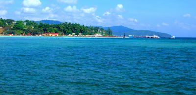
When people talk about getting around Andaman today, they are usually talking about Port Blair. It is the main entry point by air and the main administrative and ferry hub for the islands. Most visitors arrive here first, spend time on the South Andaman cluster, and then use ferries for places like Havelock, Neil, Baratang, or Diglipur depending on their itinerary.
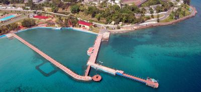
Historically, Port Blair’s natural harbour made it a practical base for ships. Its location helped authorities build a system of jetties, coastal surveillance, and supply routes. Even now, if you look at the island network as a map rather than as separate destinations, Port Blair is the point where most routes connect.
How this helps you as a traveller
If your hotel, ferry, and sightseeing plans are not centred on Port Blair, you may end up spending extra time on transfer logistics. A well-planned route usually begins with 1-2 nights in Port Blair, then moves to one or two other islands, before returning for your departure flight. That structure reduces the risk of missed ferries and rushed packing.
The sea routes that shaped island movement
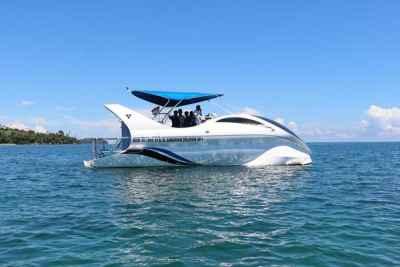
Sea travel has always defined the Andamans. Unlike a big mainland city where roads connect everything, the islands depend on ferries and boats. The main passenger routes today often include Port Blair to Havelock, Port Blair to Neil, Port Blair to Baratang, and longer government service routes toward North and Middle Andaman or Diglipur, depending on schedules and operational needs.
Navigation along these routes depends on weather, sea state, and port coordination. During monsoon months, the sea can become rougher and some crossings may be delayed or adjusted. That is why seasoned travellers treat ferry schedules as indicative and confirm them again before travel.
Old navigation lessons still show up today
Modern boats use electronic systems, but captains still pay attention to tide windows, visibility, and local water conditions. In a sense, the old discipline of reading the sea has not disappeared; it has simply been updated with better instruments. This is why a short crossing can sometimes feel easy on one day and noticeably choppier on another.
From paper charts to GPS: how navigation changed
In earlier decades, navigation in the Andamans depended heavily on paper charts, local knowledge, lighthouses, and manual observation. Today, most boats and ferries use GPS-based navigation, route plotting, and communication systems that make movement safer and more predictable. Still, the islands are not a place where you should assume everything runs like a metro timetable.
Road travel is also map-dependent because many island roads are narrow, winding, and bordered by forest or coastline. Distances can look short on a map but take longer in real driving conditions. For example, a transfer that appears to be just a few kilometres may still take 20-45 minutes depending on road conditions and stops.
If you are self-driving a scooter or car, offline maps are helpful because mobile signal can be patchy in some stretches outside Port Blair. Save hotel locations, ferry jetties, and landmark names in advance. This simple habit saves time and avoids confusion when you arrive after dark or during rain.
Important islands and how to read them on a trip map
Andaman trips become easier when you think in clusters rather than in a single list of places. South Andaman holds Port Blair, Corbyn’s Cove, Chidiya Tapu, Wandoor, and the main airport access. The island of Swaraj Dweep, commonly called Havelock, is known for Radhanagar Beach and scuba centres. Shaheed Dweep, or Neil, is smaller and easier to navigate on foot or by short local transport. Baratang lies toward the north of South Andaman and is known for forested routes and limestone caves.
If you are heading farther north, islands like Diglipur and Mayabunder require a longer time commitment. These are not add-on visits for a rushed holiday. They usually suit travellers who have at least 7-10 days and want a broader view of the archipelago.
| Area | Typical access | Approximate travel time from Port Blair | Good for |
|---|---|---|---|
| Port Blair | Airport, roads, ferries | 0-30 minutes within town | First night, museum visits, ferry hub |
| Havelock / Swaraj Dweep | Passenger ferry | About 1.5-2.5 hours by sea | Beaches, diving, relaxed stays |
| Neil / Shaheed Dweep | Passenger ferry | About 1-2 hours by sea | Short stays, slower pace |
| Baratang | Road plus limited ferry segment | Usually a full day trip | Caves, mangroves, forest route |
| Diglipur | Long road route or special arrangements | Many hours from Port Blair | Longer itineraries, northern islands |
Maps, lighthouses, and coastal safety
Lighthouses have long played an important role in Andaman navigation. They guided ships along difficult coastlines and helped reduce the risk of grounding near reefs or shallow patches. For travellers, lighthouses are more than scenic stops; they are part of the island’s maritime memory.
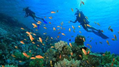
Coastal safety is still an active concern because of changing sea conditions and the remote location of many islands. If you plan marine activities such as scuba diving, snorkelling, or sea walking, always follow operator instructions closely. Choose licensed providers, ask about weather checks, and do not insist on a trip if the sea condition advice is poor.
Practical navigation tips for your Andaman trip
Once you land, the best way to move around depends on your itinerary. In Port Blair, taxis and cabs are common for airport and sightseeing transfers. On Havelock and Neil, local transport is limited compared with mainland tourist cities, so it helps to pre-arrange pickups through your hotel or tour operator. For ferry-based trips, carry soft luggage instead of bulky hard suitcases because port movement is easier that way.
- Book ferries early: Popular routes can sell out, especially in peak season from October to April.
- Keep buffer time: Do not schedule your flight on the same day as a long ferry if you can avoid it.
- Download offline maps: Signal can be uneven outside main town areas.
- Carry printed or saved confirmations: Helpful if mobile data is unavailable at the jetty.
- Plan around weather: Monsoon months can affect sea movement and ferry timings.
For budgeting, a city taxi in Port Blair may cost roughly ?500-?1,500 depending on distance and duration, while inter-island ferry fares can vary widely by operator and class, often ranging from around ?800-?3,500 per person. Hotel prices typically start around ?2,500-?4,000 per night for simple stays and can rise to ?8,000-?15,000 or more in premium beach areas during busy dates. These are indicative figures only, and you should confirm current prices before booking.
Best time to understand Andaman navigation at its easiest
If you want the smoothest travel experience, plan your visit between October and April. These months usually offer calmer seas, clearer skies, and more dependable ferry operations. The summer-to-monsoon transition can still be enjoyable, but it needs more flexibility in case of schedule changes.
For historical interest, this period also makes it easier to appreciate how island movement works because you can actually see the links between ports, beaches, and roads without weather disruptions dominating your plans. If you travel in the monsoon season, keep your itinerary lighter and avoid overpacking multiple ferry connections into one day.
Frequently Asked Questions
Why are maps especially important in Andaman?
The islands are spread out over the sea, so roads alone cannot connect everything. Maps help you understand ferry points, road distances, beach access, and the realistic time needed to move between places. In Andaman, good map reading can save a whole day.
Is Google Maps enough for travelling around Andaman?
It is helpful, but not always enough. In some areas, signal can be patchy and location pins may not be perfectly accurate for jetties, beaches, or resort entrances. Save offline maps and keep your hotel contact handy.
Which islands are easiest to navigate for first-time visitors?
Port Blair, Havelock, and Neil are the easiest starting points. They have the most straightforward tourist movement and the best combination of transport, stay options, and activity access. If it is your first trip, these three usually make the most sense.
How much time should I keep between ferry and flight?
Keep a generous buffer, ideally a half day if your ferry is on the same day as departure. Sea delays can happen, and checking in for domestic flights with comfort is easier when you are not rushing from the jetty. If possible, avoid planning your final ferry on the same day as your flight.
Are ferries in Andaman reliable?
They are the backbone of island travel and usually operate well, but weather and operational changes can affect timings. Government and private ferries may have different schedules and booking rules. Always reconfirm close to travel date.
Can I explore the islands by road alone?
Not fully. Roads are useful within individual islands, but the Andamans are a chain of islands, so ferries are essential for moving between them. A road-only plan will leave out the real structure of the destination.
Conclusion
Andaman is not just a beach destination; it is a place where the history of maps and navigation still shapes every journey you make. From old sea charts and lighthouse routes to modern ferries and GPS, the islands have always rewarded travellers who plan with care. If you understand the layout before you go, your trip becomes smoother, more relaxed, and far more enjoyable.
If you found this guide useful, share the post with someone planning an Andaman trip.
Disclaimer : The information provided in this blog is for general informational purposes only. While we strive to keep the content accurate and updated, TravelSetu assumes no liability for errors or omissions. If you believe any part of this blog infringes your rights or causes concern, please notify us immediately at info[at]travelsetu[dot]com so that appropriate action can be taken.