Andaman Marine Survey and Mapping
If you are planning a trip to the Andaman Islands and want more than beaches and water sports, this guide will help you understand the island’s lesser-known marine survey and mapping landscape. It is written for curious travellers, students, researchers, and families who want to know what marine surveying means in Andaman, where it happens, when to go, and how to plan a practical trip around it.
Andaman is not only about coral lagoons and sunset cruises. It is also one of India’s most important island regions for charting coastlines, studying seabeds, checking navigation channels, and documenting fragile marine habitats. If you are visiting with an interest in science, geography, ecology, or simply want a smarter way to explore the islands, this article will give you a clear, travel-friendly overview.
What Marine Survey and Mapping Means in Andaman
Marine survey and mapping in Andaman refers to the work of measuring and documenting the sea around the islands. This can include hydrographic surveys, seabed mapping, coastal erosion studies, coral and seagrass assessment, and navigation chart preparation. For travellers, it matters because the same data that helps ships move safely also supports tourism, conservation, and better coastal planning.
In simple terms, survey teams study water depth, underwater terrain, currents, shorelines, and hazard zones. In Andaman, this work is especially important because the islands are spread out, the waters change quickly, and many areas are ecologically sensitive. The result is a region where travel, fishing, shipping, and conservation all depend on accurate marine information.
Why Andaman Is Important for Marine Surveys
The Andaman archipelago sits along strategic sea routes and includes hundreds of islands, reefs, sandbars, creeks, and sheltered bays. That geography makes it a natural focus for mapping. Even a small shift in weather, tides, or sediment can change a boat approach, a jetty access point, or the safety of a diving zone.
For Indian travellers, this means the islands offer a rare combination of scenic travel and real-world marine science. Port Blair, Havelock Island, Neil Island, Diglipur, Mayabunder, Baratang, and Little Andaman each present different coastal conditions. A route that is calm in one month may feel very different in another, so marine mapping is not just technical work; it directly affects how you travel here.
Where Marine Survey Work Is Visible to Visitors
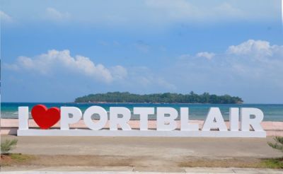
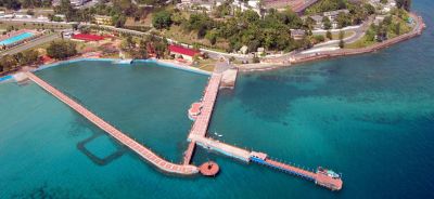
You may not always see survey teams at work, but their impact is visible in ports, jetties, ferry routes, and protected marine zones. Port Blair is the most obvious starting point because it functions as the administrative and transport hub. Around the harbour, you can notice regulated channels, port activity, and the careful movement of passenger vessels.
In Havelock Island, near Radhanagar and the ferry landing points, marine and coastal management is tied closely to tourism pressure and coral protection. Neil Island has shallow, calm waters where shoreline changes can be observed more easily. In the north, Diglipur and nearby areas such as Ross and Smith Islands are useful for understanding how sandbars, currents, and tidal movement shape the coast. Even if you are not joining a formal survey, these places help you see why mapping is essential.
Best Time to Plan a Marine-Focused Trip
The best time to visit Andaman for marine-related travel is usually from October to May, when sea conditions are more favourable and ferry operations are generally smoother. For underwater visibility and boating, December to March often works well, though conditions can still vary from day to day. Monsoon months, roughly June to September, bring stronger winds, rougher seas, and more schedule disruptions.
If your interest is photography, boat-based exploration, or learning about marine habitats, plan for a minimum of 5-7 days. That gives you enough time to cover Port Blair, one island such as Havelock or Neil, and at least one offbeat coastal area. For a more serious research-style or educational visit, 8-10 days is more comfortable because weather changes can affect marine activities.
How to Explore Andaman With a Marine Survey Mindset
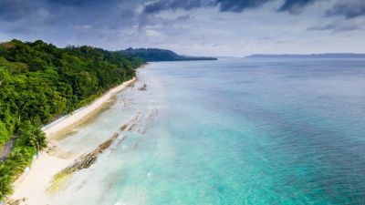
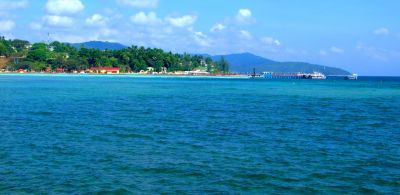
You do not need to be a scientist to appreciate marine mapping. A traveller can approach Andaman with a sharper eye by observing tidal shifts, mangroves, reef edges, and harbour layouts. Start at a beach in the morning and revisit at low tide in the afternoon; you will notice how much the shoreline changes. On a ferry ride, pay attention to colour changes in the water, which often indicate depth changes, sandbanks, or reef areas.
Good places to observe coastal patterns
- Port Blair harbour area for ferry movement, protected channels, and port activity
- Chidiya Tapu for mangroves, tidal flats, and sunset coastal views
- Havelock Island for reef-adjacent beaches and water clarity differences
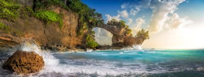
- Neil Island for low-lying shores, natural rock formations, and tide effects
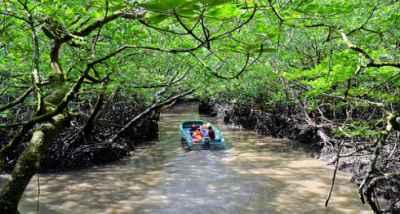
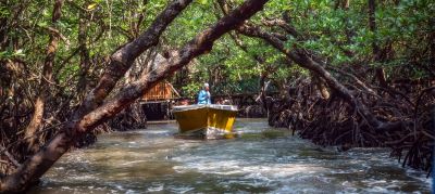
- Baratang for mangrove creeks and sediment-rich waterways
If you are travelling with children or students, this style of trip can become a live geography lesson. Ask them to note where the water is calm, where the bottom seems visible, and where boat movement is restricted. These small observations help make the island’s marine geography feel real.
Activities That Pair Well With Marine Survey Interest
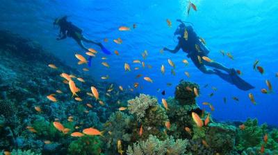
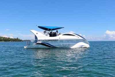
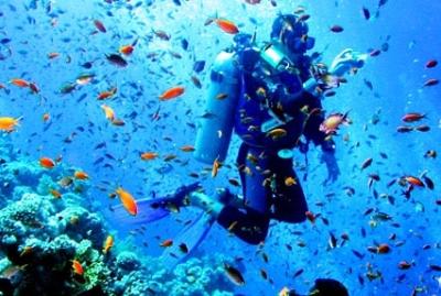
Andaman is full of experiences that connect directly with marine awareness. Snorkelling and scuba diving are the most obvious choices, but glass-bottom boat rides, mangrove boat tours, and inter-island ferry journeys are equally useful if you want to understand the waters better. These activities give you a sense of how reefs, channels, and currents shape travel around the islands.
For a practical trip, you might combine a dive session in Havelock with a mangrove cruise in Baratang, then add a ferry journey back to Port Blair. That mix helps you compare clear reef water, creek water, and open-sea movement. If you are interested in marine ecology, ask local operators about reef-safe practices, tidal timing, and what areas should not be touched or stepped on.
Indicative costs for common marine-related experiences
| Experience | Approximate cost | Typical duration |
|---|---|---|
| Glass-bottom boat ride | ?800-?2,000 per person | 20-45 minutes |
| Snorkelling | ?1,500-?3,500 per person | 1-2 hours |
| Scuba diving for beginners | ?3,500-?6,500 per person | 2-3 hours including briefing |
| Mangrove boat tour | ?1,200-?2,500 per person | 1-2 hours |
These are indicative ranges and can change with season, operator, equipment, and boat type. Always confirm current rates before booking, especially during holiday periods.
Practical Travel Planning for Andaman
For a marine survey and mapping-focused trip, stay in Port Blair for at least two nights so you can manage airport arrival, sightseeing, and ferry connections without rushing. Then add 2-3 nights in Havelock or Neil, depending on whether you prefer more activity or more relaxed coastal observation. If you want to include the northern or remote regions, extend your trip by a couple of days.
Transport planning matters here. Ferries, local boats, and road transfers can be affected by sea conditions, and schedules sometimes shift at short notice. Keep one buffer day if you have a return flight from Port Blair. This is especially helpful if you are travelling in peak season between December and February.
Useful packing list for this kind of trip
- Light cotton clothing and one rain layer
- Reef-safe sunscreen and a reusable water bottle
- Water sandals or shoes that handle wet surfaces
- Dry bag for phones, documents, and camera gear
- Binoculars or a camera with zoom if you enjoy observing coastlines
- Any personal medication, especially for motion sickness
Respecting the Marine Environment
Andaman’s marine environment is fragile, and responsible behaviour matters more here than in many beach destinations. Avoid stepping on coral, do not collect shells or marine life, and follow local instructions around protected zones. Even simple actions like carrying back your plastic waste and using non-abrasive sunscreens can reduce impact.
If you are joining a boating or diving operator, choose one that follows safety and conservation rules. Ask whether they brief guests on reef protection, whether they avoid anchoring on sensitive areas, and how they manage waste. Good operators usually welcome these questions.
Suggested 5-Day Itinerary for Curious Travellers
If you want a balanced introduction to marine survey and mapping ideas in Andaman, this sample plan works well for most Indian travellers.
- Day 1: Arrive in Port Blair, visit the harbour area, and watch the waterfront in the evening.
- Day 2: Explore Chidiya Tapu and nearby coastal stretches for mangroves and tidal movement.
- Day 3: Travel to Havelock Island and spend time comparing beach, jetty, and reef environments.
- Day 4: Do snorkelling or a beginner dive, depending on comfort and weather.
- Day 5: Visit Neil Island or return to Port Blair with a stop at a coastal viewpoint.
This plan is practical because it keeps travel time realistic and leaves room for ferry delays. It also gives you a good cross-section of Andaman’s marine character without turning the trip into a rush.
Where to Stay and What to Budget
For a comfortable mid-range trip, budget around ?5,500-?10,000 per day per person if you include stays, local transfers, food, and one paid marine activity. Simple guesthouses can cost ?2,000-?4,000 per night, while good mid-range resorts may fall in the ?6,000-?12,000 range depending on island and season. Premium beachfront stays can cost much more, especially during Christmas, New Year, and long weekends.
Food is usually straightforward and pleasant, with seafood widely available in tourist areas. Expect roughly ?300-?800 per meal at casual restaurants, and more at resort dining rooms. Always check in advance if you need early breakfasts or packed meals for ferry days.
Frequently Asked Questions
What is the best month for marine activities in Andaman?
December to March is generally the most comfortable period for sea-based activities because the weather is steadier and the water tends to be calmer. October, November, April, and early May can also work well. Still, conditions can change quickly, so confirm locally before booking any boat, snorkelling, or diving plan.
Can a regular tourist understand marine survey and mapping in Andaman?
Yes, absolutely. You do not need technical training to notice tide patterns, ferry routes, reef zones, and mangrove systems. If you are curious, even a simple island-hopping holiday can become an educational trip.
Are marine survey areas open to visitors?
Some areas are visible from public spaces such as ports, beaches, ferries, and viewpoints, but active survey zones may not be open to tourists. If a location is near a port, protected habitat, or operational work site, follow local rules and stay outside restricted areas. Access depends on local permissions and safety conditions.
How many days do I need for an Andaman trip focused on marine experiences?
A minimum of 5 days is useful if you want to cover Port Blair and one island like Havelock or Neil. For a richer experience with boat rides, snorkelling, mangrove areas, and relaxed travel, 7-8 days is better. If you want to include northern or more remote coastal regions, add extra days for weather flexibility.
Is Andaman suitable for students and educational groups interested in marine studies?
Yes, Andaman is very suitable for school groups, college students, and environmental clubs. The islands offer real examples of coastal ecology, marine conservation, ferry navigation, and habitat sensitivity. Just plan transport and accommodation early, especially for larger groups.
Do I need any special permit for marine-related sightseeing in Andaman?
Most Indian travellers do not need a special permit for standard sightseeing in the main tourist areas, but rules can vary for certain islands, protected zones, and restricted locations. Foreign nationals and some specific routes may have different requirements. Always verify the latest rules before you travel.
Andaman is a place where sea travel, science, and holiday time naturally meet. If you plan your days with a marine survey mindset, you will notice more than pretty beaches: you will understand how these islands breathe, move, and stay connected by water.
If you found this guide useful, share the post with friends or family planning an Andaman trip.
Disclaimer : The information provided in this blog is for general informational purposes only. While we strive to keep the content accurate and updated, TravelSetu assumes no liability for errors or omissions. If you believe any part of this blog infringes your rights or causes concern, please notify us immediately at info[at]travelsetu[dot]com so that appropriate action can be taken.