If you are planning a trip to Sikkim and want to do it properly, good guidebooks and trail maps will save you time, money and confusion. This guide is for Indian travellers who want to understand where to find reliable Sikkim information, how to use trail maps for day walks and longer treks, and what to carry before heading to places like Gangtok, Yuksom, Lachung, Yumthang and Dzongri.
Sikkim looks small on a map, but once you start planning roads, permits, weather windows and altitude, you realise why a proper trail map matters. In the next sections, you will find practical suggestions on what to read, how to plan routes, which areas need extra caution, and how to combine guidebooks with offline maps so your North-East trip feels organised instead of rushed.
Why Sikkim needs better planning than a regular hill trip
Sikkim is one of those destinations where a nice hotel booking is only the beginning. Roads can be slow because of landslides, army checks, weather interruptions and mountain traffic. A drive that looks like 90 km on paper can easily take 4-6 hours, especially on routes from Gangtok to Lachung, Lachen, Yumthang Valley or Yuksom.
That is why guidebooks and trail maps are useful even if you are not trekking every day. They help you understand where the roads end, where shared cabs usually stop, what time of year certain passes become risky, and which villages make sense as overnight bases. For North-East travel, this kind of planning makes the trip smoother and safer.
What to look for in a Sikkim guidebook
A useful Sikkim guidebook should do more than list sightseeing spots. It should explain transport, altitude, permit requirements, road conditions and realistic travel times. If you are travelling from Kolkata, Siliguri, New Jalpaiguri or Bagdogra, a good book should also help you connect the journey into Sikkim rather than treating it like a separate world.
Useful features to check
- Route explanations: Gangtok to Pelling, Gangtok to Lachung, Yuksom to Dzongri, and similar routes with approximate travel hours.
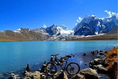
- Altitude notes: Especially for Nathula, Tsomgo Lake, Gurudongmar, Dzongri and Goechala access points.
- Permit guidance: Where permits are needed, who usually arranges them, and what documents you must carry.
- Season advice: Best months for clear views, rhododendrons, monsoon caution and winter closures.
- Village-level detail: The difference between staying in Gangtok, Ravangla, Pelling, Yuksom, Lachung or Lachen.
For many travellers, a small printed guidebook works best when paired with a phone map. Printed books are handy when data is weak, while digital maps help you check live routes and driving times. If you are buying a guidebook online or at a bookstore, look for editions that mention current road access and not just old sightseeing descriptions.
Trail maps for Sikkim: what they should show
Trail maps are especially important if you plan to walk beyond viewpoints and monasteries. Sikkim has short forest walks, village walks and full trekking routes, and the difference between them is huge. A proper trail map should show elevation gain, water points, ridge lines, campsites and exit routes in case you need to shorten your trek.
Common trail types in Sikkim
- Day walks: Around Gangtok, Khecheopalri Lake, Ravangla, Yuksom and Pelling.
- Moderate treks: Yuksom to Sachen or Tshoka, or parts of the Dzongri trail.
- High-altitude treks: Dzongri and Goechala routes, usually for fit trekkers with proper acclimatisation.
- Village and monastery trails: Easy walks near Rumtek, Tashiding, Pemayangtse and Enchey.
If you are not an experienced trekker, focus on trail maps that clearly separate a scenic walk from a serious mountain route. In Sikkim, that distinction matters because weather and altitude can change the difficulty fast. A 6 km trail at 1,700 metres is very different from a 6 km trail near 4,000 metres.
Best places to pick up maps and local information
You do not need a specialist shop for every trip, but it helps to collect information from a few reliable points before starting. In Gangtok, local tourism offices, well-reviewed travel desks and experienced homestay hosts can usually point you to updated route notes. In Yuksom and Pelling, local operators often know the latest trek access conditions better than generic internet searches.
At bigger transit points such as Bagdogra, New Jalpaiguri and Siliguri, you may find basic North-East travel guidebooks and road maps. These are useful for the larger road network, while your accommodation in Sikkim can help with local route details. Always confirm if a map is current, since road alignments and access rules can change after rains or maintenance work.
If you prefer digital planning, download offline maps before entering remote stretches. Mobile networks can be patchy on the way to North Sikkim and around some high mountain corridors. A paper map is still worth carrying, especially for multi-day trekking routes where a phone battery can fail faster in the cold.
How to plan popular Sikkim routes with a map
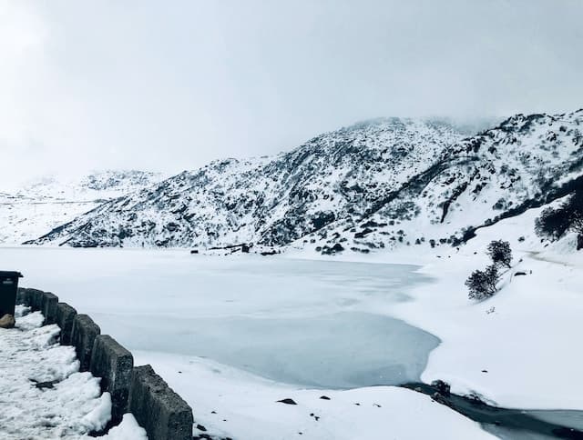
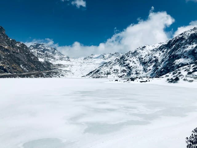
Here is where a trail map and a road map work together. Sikkim travel often looks simple until you compare actual distances and hill driving time. For example, a trip from Gangtok to Tsomgo Lake and Nathula can take most of the day even though the distance is not huge. Similarly, Gangtok to Yuksom may be a manageable drive, but once you start a trek from Yuksom, the map details become much more important than on-road directions.
| Route | Approx. travel time | Why the map matters |
|---|---|---|
| Gangtok to Tsomgo Lake | 3-4 hours one way | Checks for permits, weather, and return timing |
| Gangtok to Lachung | 6-8 hours | Road conditions and meal stops matter |
| Gangtok to Lachen | 6-8 hours | Useful for planning an overnight halt |
| Yuksom to Tshoka | Usually 1-2 days trekking | Elevation gain and camping points are key |
| Yuksom to Dzongri | 3-4 trekking days | Altitude and acclimatisation notes are essential |
When comparing maps, do not rely only on straight-line distance. In Sikkim, roads twist with the terrain, and trail ascent matters more than distance alone. A map that shows contours, not just roads, is much more valuable for your planning.
Trail-map basics for trekkers and day hikers
If you are trekking in West Sikkim, especially around Yuksom, Dzongri or Goechala, choose maps that show major landmarks like Sachen, Bakhim, Tshoka, Phedang and Dzongri Top. These names help you pace your day and decide where to stop. For short hikes, such as around Ravangla or near Khecheopalri Lake, a simpler route map is enough.
What to carry on the trail
- Printed map in a waterproof pouch
- Offline map on your phone
- Power bank
- Basic altitude and weather notes
- Emergency contact numbers from your hotel or trek operator
Many travellers underestimate how quickly weather can turn on mountain trails. Morning sunshine in Sikkim can become mist, drizzle or wind by afternoon. A route map that shows forest cover, exposed sections and ridgelines helps you decide when to begin, when to turn back and whether it is worth starting late.
Permits, seasons and route restrictions you should know
Some Sikkim destinations require permits, and rules can change depending on current administration and border sensitivity. Typical places that may need permit-related planning include Tsomgo Lake, Nathula, North Sikkim areas such as Lachung, Lachen and Gurudongmar, and certain trekking routes in protected zones. Your hotel, local travel agent or tour operator usually helps with this, but you should still carry original ID and extra copies.
For most travellers, the best months are usually March to May and October to early December, when roads and views are often better. June to September brings monsoon challenges, landslides and visibility issues, while deep winter can bring snow and road closures in higher areas. Before booking any route, confirm access, permit status and road conditions because these are among the most changeable parts of Sikkim travel.
Budgeting for guidebooks, maps and local help
Guidebooks are not expensive, but practical route help can still affect your budget. A basic travel guide or printed map may cost around ?300-?800, while a more detailed regional guidebook can go up to ?1,500 or more depending on the publisher and edition. Local trekking support, if you hire it, will cost much more, but for remote routes it is often worth the peace of mind.
If you are booking transport and local services through a package, expect shared cab costs, sightseeing transfers and permit help to vary by season. A Gangtok hotel might be ?2,500-?5,000 per night for a decent mid-range stay, while homestays in smaller towns can begin around ?1,200-?2,500 per night. As always, confirm current rates before booking because mountain prices can change quickly in peak season.
Frequently Asked Questions
Do I really need a guidebook for Sikkim if I use Google Maps?
Google Maps is useful, but it will not fully explain altitude, permits, weather sensitivity or trekking logistics. A guidebook gives you context that digital maps often miss, especially for routes in North Sikkim and West Sikkim. The best approach is to use both.
Are trail maps necessary for day walks too?
Yes, especially if the walk is on uneven ground or passes through forest sections. Even short routes in hill areas can have slippery stretches, steep climbs or unclear turn-offs. A trail map helps you estimate time more accurately and avoid drifting onto the wrong path.
Can I buy maps after reaching Gangtok?
Usually yes, but selection can be limited and editions may not always be current. It is better to carry at least one map or download offline maps before you arrive. If you are planning a trek, try to get route information from your operator in advance.
Which area is best for first-time visitors to start with?
Gangtok is usually the easiest base for first-time travellers because it connects well to Tsomgo Lake, Nathula, Rumtek and nearby viewpoints. If you want a slower pace, Pelling and Ravangla are also good starting points. For trekking, Yuksom is the key base in West Sikkim.
Is Sikkim safe for solo travellers using public routes and maps?
Sikkim is generally considered comfortable for many solo travellers, but mountain travel still requires common sense. Stick to known routes, avoid starting late, keep local contact numbers handy and check weather before long drives or hikes. If you are going to remote areas, it is smarter to travel with a local operator or group.
What should I confirm before booking a North Sikkim trip?
Check road access, permit requirements, hotel availability, and whether the route is open on your chosen dates. North Sikkim is the part of the state most affected by weather and changing conditions. A local operator should give you the latest update, but you should still verify everything shortly before departure.
Conclusion
Sikkim rewards travellers who prepare well, and the right guidebooks and trail maps make that preparation much easier. Whether you are planning a relaxed hill holiday or a serious trek from Yuksom toward Dzongri, having the right map in hand helps you move with confidence through North-East India.
If this guide helped you plan your Sikkim trip better, share this post with someone who is also preparing for a North-East journey.
Planning a North-East trip?
Tell us your dates and who is travelling. Up to three local travel companies send you their itinerary and price.
Get free quotesDisclaimer: The information in this blog is for general information only. We try to keep it accurate and up to date, but TravelSetu accepts no liability for errors or omissions. If you believe any part of it infringes your rights, please write to info@travelsetu.com.